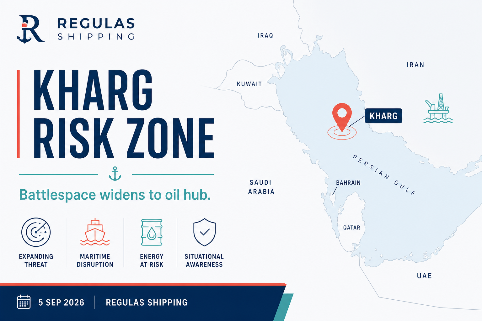
The 5 September 2026 disabling of M/T Downy off Kharg Island is strategically different from recent Hormuz-approach projectile incidents. Kharg lies about 16 miles off Iran’s coast in the northern Persian Gulf — roughly 300 miles northwest of Hormuz — and before the war handled on the order of 90 percent of Iranian crude exports. Striking a tanker there signals that the naval conflict’s economic targeting now reaches Iran’s oil heartland, not only the strait’s traffic lanes.
For non-Iranian commercial shipping, the widening map increases the chance of temporary exclusion zones, heightened naval activity, AIS spoofing/confusion and misidentification. Ships involved in STS, bunkering or waiting areas in the wider Gulf may find themselves closer to active targeting than voyage plans assumed when risk was framed as “Hormuz only.” Insurers are likely to revisit Gulf trading warranties and additional premiums for northern Gulf as well as TSS waters.
Operators should refresh passage planning templates, war-risk questionnaires and crew briefings to include Kharg/north Gulf contingencies alongside Musandam and Bab el-Mandeb modules. Dual-chokepoint risk is now matched by a deeper intra-Gulf kinetic zone.
What Operators Should Note
- Add Kharg/north Gulf modules to company security assessments immediately.
- Reconfirm insurance warranties for any residual Gulf waiting or STS areas.
- Avoid lingering near Iranian export infrastructure unless voyage-essential and authorised.
- Monitor naval warning broadcasts on emergency channels throughout Gulf passages.
- Separate Iran-export exposure from third-country Gulf calls in risk registers.
Regulas Shipping will continue mapping how Kharg-area escalation changes practical limits for commercial Gulf operations.