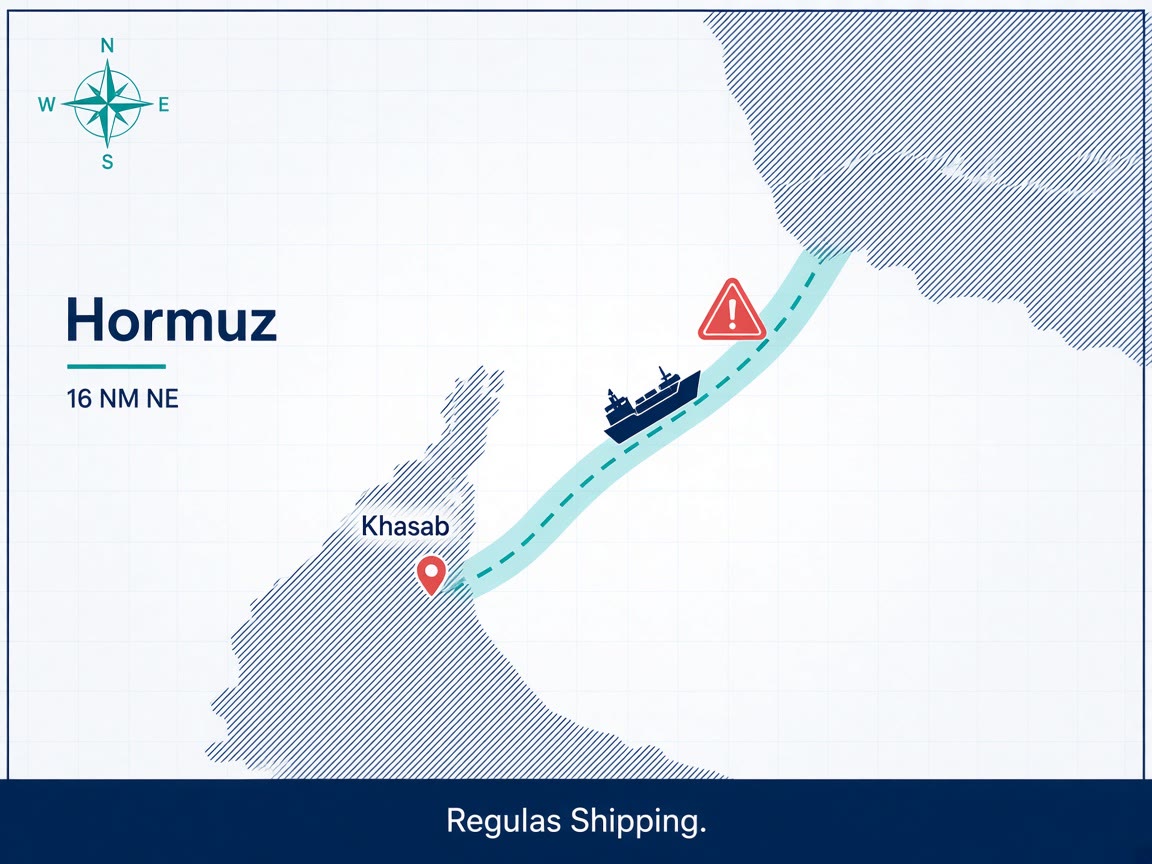
The UK Maritime Trade Operations centre said on Thursday, 17 September 2026, that a vessel had been attacked on the Omani side of the Strait of Hormuz, about 16 nautical miles northeast of Khasab on the Musandam peninsula. The crew was reported safe. No environmental impact had been confirmed. UKMTO did not name the ship, did not give a time, and did not describe the weapon or the damage. Authorities are investigating. Vessels were told to transit with caution and to report suspicious activity.
That is a named-location incident on the southern, Omani-side approach, not a tracker anecdote and not a U.S. media leak. Anadolu Agency, Arab Times and TradeWinds all carried it as an attack. Reuters and market wires used “security incident.” Newsquawk logged the UKMTO product on the live feed at about 1930 UTC on Thursday. Until UKMTO or a flag circular upgrades the classification, company security officers should brief the position, the Omani-side geometry and the “crew safe / no pollution confirmed / hull unnamed” facts. They should not invent a projectile count, a fire, or a ship name to fill the gap.
The operational point is where it sits. Sixteen nautical miles northeast of Khasab is inside the strait, on the corridor owners still treat as the southern Omani option against Iran’s directed hails onto the northern route. It is a different file from Wednesday’s three-ship Kpler count, from the still-unnamed U.S.-contracted hull reported hit with drones and a missile between 15 and 16 September, and from the 10 September UKMTO warning of four projectiles against two unidentified vessels four nautical miles west of Khasab. Stacking those events into one paragraph hides the decision the next master actually faces: the Omani-side lane is being struck even when the last published commodity count is already in single digits.
What Thursday’s warning actually said
UKMTO’s public product, as carried by Anadolu, Arab Times and Türkiye Today, is short. Location: 16 nautical miles, nearly 30 kilometres, northeast of Khasab. Side: Omani. Outcome: crew safe; no environmental impact confirmed. Identity: not released. Nature and time of the attack: not released. Follow-up: authorities investigating; transit with caution; report suspicious activity. TradeWinds, publishing early on Friday, 18 September, treated it as another attack off Khasab and repeated that the crew was safe. No IMO number, MMSI, flag, type or cargo has been attached to the hull in those accounts.
The wording split matters for the SMS, not for the passage plan. “Attack” is how the maritime press has labelled it. “Security incident” is how some wires first moved it. Both rest on the same UKMTO location. Neither is a confirmation of a missile, a UAV, a mine or small-boat fire. Company security officers who write “projectile” or “drone” into Thursday’s night orders are ahead of the product. Extra lookouts, a UAV watch, citadel and fire party, and a written instruction not to close small-boat or unmanned-surface contacts are already in the Hormuz standing orders. Thursday adds a fresh Khasab fix, not a new weapon type.
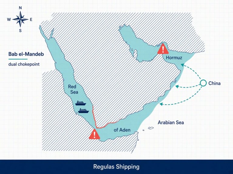
Khasab is not a random coastal town. It sits on Oman’s Musandam peninsula, which juts into the strait and anchors the southern side of the traffic. UKMTO has used Khasab as the reference point for a string of 2026 warnings, including unknown-projectile strikes east and west of the town through August and early September. Warning 133-26 on 10 September put four projectiles onto two unidentified vessels four nautical miles west of Khasab, with one ship reported on fire. Thursday’s 16-nautical-mile northeast position is east of that earlier fix. It is also distinct from the Panama-flagged products tanker El Gaia, IMO 9325336, which suffered an engine-room fire and oil spill off Musandam on 13 September and was later taken under tow toward an Omani port. Do not merge Thursday’s unnamed hull with El Gaia, with Warning 133-26, or with the U.S.-contracted ship that Fox News and EOS Risk Group described without a UKMTO identifier.
How it sits on a three-ship strait
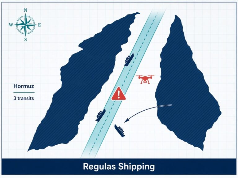
Preliminary Kpler data reported by Reuters on Thursday morning put Wednesday’s AIS-visible commodity transits at three, against 12 on Tuesday in the revised feed and a ten-day average of about 17. The mix was an empty Supramax entering on the Iranian-managed route, an empty products tanker entering on a dark route, and a Panamax tanker exiting on a dark route. No VLCC. No LNG carrier. Those figures exclude ships that may have passed with Automatic Identification System transponders off. Thursday’s UKMTO product therefore lands on a waterway that is already commercially closed in all but name. An attack, even on an unnamed hull with the crew safe, is the kind of loss data war-risk underwriters use when the next owner asks whether the southern Omani corridor is still the less-bad option.
JMIC’s threat rating for the strait remains SEVERE. AIS-on ships can still expect directed hails toward the northern Iranian-controlled route. The U.S. blockade of Iranian ports remains in force, with visit-and-search, a strong naval presence and a 30-nautical-mile standoff from U.S. units still in the industry guidance. IMO Secretary-General Arsenio Dominguez told Member States on 16 September that the Organization had verified 80 attacks on international shipping in and around Hormuz since 28 February, with at least 22 seafarer deaths. Thursday’s unnamed, no-casualty product does not move that verified file by itself. It does show that the southern Omani side, which some passage plans still treat as the residual TSS, is not a sanctuary.
CENTCOM continues to say the strait is open and that U.S. forces have assisted residual commercial movements under naval cover. That is a military logistics picture. Three AIS-visible commodity transits on Wednesday and a UKMTO attack report on Thursday are the commercial picture. Facilitation of residual barrels does not restore a lane that owners, crews and insurers will use. If the next fixture still assumes that “Omani side” equals a lower residual risk than the Iranian-managed northern route, Thursday’s 16-nautical-mile northeast fix is the reason to rewrite that sentence before the ship is stemmed.
What it changes on the bridge
A named Khasab attack with the crew safe is an ISPS and reporting problem before it is a cargo problem. The master who is already in the strait needs a written rule for when to call UKMTO, Oman MRCC and the company security officer, and a written rule for whether to continue, abort to Fujairah or Khor Fakkan, or accept a directed hail onto the northern route. The master who has not yet offered the voyage needs a different decision: whether the fixture is still worth a SEVERE-rated strait that is producing UKMTO products on both the west and northeast of Khasab in the same week as a three-ship commodity count.
War-risk warranties that require prompt notice of a material change in the risk should be read against Thursday’s product, not against next week’s tracker print. A UKMTO attack/incident on the Omani side is a material change for any hull whose additional premium was quoted on the assumption that residual traffic would use a quieter southern corridor. Crew contracts that allow seafarers to refuse a designated war-risk area are the second stop. An owner cannot sail a ship that cannot be manned. Thursday’s “crew safe” line will not, by itself, reopen those contracts.
Company security officers should keep Thursday’s hull unnamed in standing orders until a warning update, a flag circular or a coastal-state notice carries IMO, MMSI or a ship name. A wrong identification is worse than an unnamed position. What can go into the voyage order now is the 16-nautical-mile northeast-of-Khasab fix, the instruction to treat the Omani-side lane as live targeting water, and the existing UAV, small-boat and 30-nautical-mile U.S. unit procedures. That is enough for the next Hormuz stem. It is not a reason to thin BMP Maritime Security because the last published casualty on this particular hull was zero.
What Operators Should Note
- Log Thursday’s UKMTO product as a named Khasab attack/incident, hull unnamed. Location: 16 nautical miles northeast of Khasab, Omani side of Hormuz. Crew reported safe. No environmental impact confirmed. Nature, time, flag, type and cargo not released. Anadolu, Arab Times and TradeWinds used “attack”; Reuters used “security incident.” Brief the position. Do not invent a weapon.
- Do not merge this file with Warning 133-26, El Gaia, or the U.S.-contracted hull. 10 September’s four projectiles were about four nautical miles west of Khasab. El Gaia is the 13 September Musandam fire and tow. The U.S.-contracted ship remains a media-sourced report without a UKMTO identifier. Thursday’s 16-nautical-mile northeast fix is a separate voyage-order line.
- Treat the Omani-side corridor as live targeting water, not as the quiet alternative to Iran’s northern route. Directed hails onto the Iranian-managed lane remain in the JMIC picture. Thursday shows that staying south of those hails is not a sanctuary. Extra lookouts, a UAV watch, and a written instruction not to close small-boat or USV contacts stay in force on both geometries.
- Keep Wednesday’s three-ship Kpler/Reuters print on the same briefing page. Empty Supramax in on the Iranian route; empty products tanker in on a dark route; Panamax tanker out on a dark route. No VLCC. No LNG. A UKMTO attack on Thursday does not reopen that commercial closure. It is why the next owner may not offer the voyage at all.
- Notice war-risk underwriters before the next stem, not after a second hit. Warranties that require prompt notice of a material change in the risk should see a UKMTO attack/incident on the Omani side. Additional premium quoted on a “southern corridor” assumption is stale. If seafarers can refuse the area, price the manning stop in the fixture.
- Write the abort and the reporting chain before the ship enters Musandam waters. Name UKMTO, Oman MRCC, the DPA and the diversion port. Fujairah and Khor Fakkan remain the practical Gulf of Oman options if the ship is outbound. A “crew safe, continue” default is not a plan if the next unnamed hull is yours.
- Do not read CENTCOM “strait is open” language as a TSS restoration. JMIC remains SEVERE. IMO’s 16 September file is 80 verified Hormuz attacks and 22 seafarer deaths since 28 February. Thursday’s no-casualty product does not cancel that accounting. Ships that still transit do so under the same warning architecture, with a fresh Khasab coordinate attached.
Regulas Shipping will keep lining UKMTO, JMIC and Kpler products against the Khasab approaches so operators can treat Thursday’s unnamed 16-nautical-mile attack report as a southern-corridor routing and insurance decision, not as residual peacetime traffic off Oman.