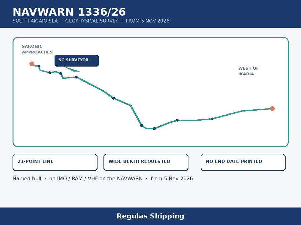
Greece’s Hellenic Navy Hydrographic Service has printed a numbered geophysical-survey warning that opens on 5 November along a 21-point line across the South Aegean, not inside yesterday’s dedicated Central Mediterranean oceanographic track. The working primary retrieved this run is official NAVWARN 1336/2026, posted on the Hydrographic Service’s English navwarn board on 5 November 2026: SOUTH AIGAIO SEA GEOPHYSICAL SURVEY WILL BE CARRIED OUT BY ‘NG SURVEYOR FROM 05 NOV 2026 IN THE LINE BETWEEN THE POINTS: 37 45 18N – 023 07 12E, 37 44 00N – 023 09 36E, 37 43 48N – 023 11 53E, 37 41 03N – 023 12 22E, 37 39 23N – 023 18 43E, 37 39 53N – 023 22 40E, 37 38 45N – 023 25 39E, 37 35 27N – 023 27 22E, 37 36 23N – 023 35 45E, 37 27 10N – 023 52 18E, 37 21 50N – 023 59 30E, 37 16 48N – 024 10 11E, 37 03 12N – 024 17 21E, 37 01 02N – 024 20 14E, 37 00 57N – 024 25 33E, 37 04 44N – 024 34 25E, 37 06 52N – 024 40 05E, 37 06 27N – 024 50 49E, 37 07 36N – 025 02 23E, 37 12 54N – 025 21 02E, 37 14 38N – 025 40 47E. WIDE BERTH REQUESTED. That is Thursday morning’s working Hellenic coastal instrument. It is a named-hull survey line, not a rewrite of Monday afternoon’s dedicated NAVAREA III 0169/26 Britoil Centurion, not a Myrtoo submarine-exercise box, and not a Hormuz Attack PDF.
The warning is a Hellenic coastal NAVWARN. It is not NAVAREA III 0169/26. It is not NAVAREA IX 428/26. It is not UKMTO 196-26. This morning’s dedicated IMO board remains 128 confirmed incidents as at 3 November, with 24 seafarer fatalities. Masters who brief Thursday morning as a South Aegean exclusion zone, as a completed RAM status on the NAVWARN text, as a 3–4 November Saronic calibration reprinted as a 21-point line, or as a Corinth Canal closure promoted onto 1336/26 will have over-read a dotted-line survey watch. 1336/26 tells the bridge which hull, which start date, and which 21 points to plot. It does not print a keep-clear radius, a VHF working channel, a flag, an IMO number, a cancel DTG, or a restricted-manoeuvre line. Hold the official wording, including the Hydrographic Service’s printed opening quote before NG SURVEYOR and the missing close-quote on the same face.
What 1336/26 actually printed
The hydrographic text is short and is the working primary. SOUTH AIGAIO SEA. Geophysical survey will be carried out by NG SURVEYOR from 5 November 2026 in the line between the 21 points listed above. Wide berth requested. Stay with that wording. The Hydrographic Service printed neither an IMO number, an MMSI, a flag, a call sign, a wreck buoy, a least depth, a fishing or anchoring prohibition, a restricted-in-ability-to-manoeuvre line, a VHF channel, a towed-gear length, a support-tug list, daily hours, nor a cancel DTG. Do not invent a five-cable or one-nautical-mile circle around any of the 21 points. 1336/26 does not print one. Do not invent a 15 February end date. That end belongs to dedicated 0169/26, the Central Mediterranean Britoil Centurion track, not to this South Aegean line. Do not invent a 051600 UTC 5 November kill time. That cancel belongs to Irakleio Radio’s wrap of today’s dedicated 1322/26 submarine box, not to this survey.
The geometry is the first briefing fact. The 21-point line starts in the southern Saronic approaches near 37-45.3N 023-07.2E, south of Aegina and west of the Poros / Methana face, and runs east-southeast through 023-18E to 023-35E, then east across the South Aegean south of Kea, Kythnos, Serifos and Sifnos, south of Paros / Naxos, and ends near 37-14.6N 025-40.8E, west of Ikaria. That is one line, not a four-corner box. It is not a circular exclusion. It is not a TSS amendment. Saronic outbound, the Hydra / Spetses face, the Kythnos–Serifos lane, the Paros–Naxos south side and the Ikaria west approach all see a point. Do not brief a Piraeus shutdown from a survey line. Do not brief a Corinth Canal rewrite. Plot the 21 points. Keep a lookout for a named survey hull that will be restricted in practice even though 1336/26 does not print COLREGS Rule 3(g) language.
The date line is the second briefing fact. Work is printed as from 5 November 2026. No end date is printed. No daily hours are printed. No night-only or daylight-only limit is printed. No weather clause is printed. Thursday morning is already 5 November. The window is open now and stays open until a later NAVWARN cancels or amends it. A passage plan that treats 5 November as a one-day survey has under-read a line that prints no kill time. A passage plan that drops the watch after 1500 UTC because 1322/26’s Myrtoo submarine box kills itself this afternoon has applied a different number’s window to this survey. 1336/26 is a named-hull radio alert. It lives from 5 November until further notice unless a later Hellenic NAVWARN cancels it.
The identification line is the third briefing fact. The Hydrographic Service named the hull. NG SURVEYOR. That is tighter than a generic “survey vessel” line. It is not an IMO print. It is not a flag print. It is not a call-sign print. It is not a restricted-manoeuvre print. Open-register and AIS colour is held separately and is not a 1336/26 fact: industry reprints this morning tagged the hull as an Italian-flag survey ship showing restricted manoeuvrability on AIS — not a NAVWARN finding, not a flag-state confirmation, and not a class survey. Do not promote an Italian flag, a RAM light, a streamer length or a DP class onto the numbered text.
Industry-reprint colour, held separately: SeaLagom first carried 1336/26 with a received stamp of 5 November 00:00 UTC and an updated stamp of 5 November 09:22 UTC, matching the Hydrographic Service’s 5 November English board. The reprint restates the 21-point line, the NG SURVEYOR name, the 5 November start and the wide-berth request. Hold that as colour of the official board, not as a second survey. Dedicated 1320/26, Saronic Gulf, calibration of subsea equipment by NG SURVEYOR on 3 and 4 November on the two-point line 37-39.67N 023-20.22E / 37-45.32N 023-07.22E, wide berth requested, is wrap on this hull — unused as a second NG SURVEYOR piece, and not a 1336 amendment. 1320/26 was a two-day Saronic calibration that closed on 4 November. 1336/26 is a 21-point South Aegean geophysical line that opens on 5 November. Do not collapse the calibration onto the survey. Do not collapse the survey onto the calibration.
What this is not
This is not a rewrite of dedicated NAVAREA III 0169/26. Monday afternoon’s dedicated piece remains oceanographic work on the Britoil Centurion, IMO 9619177, MMSI 566921000, days 5 November 2026 to 15 February 2027, dotted-line groups A and B in the Central Mediterranean, wide receipt requested. 0169/26 prints a different hull, a different sea, a different point-group and a 15 February end. 1336/26 prints NG SURVEYOR, South Aigaio Sea, a 21-point line from 37-45.3N 023-07.2E to 37-14.6N 025-40.8E, and no end date. A DPA who briefs Thursday morning as “Britoil Centurion has moved east onto 025E” has borrowed 0169/26’s name and dropped the Hellenic line. Keep those numbers on their own sheets. Dedicated 0168/26 remains weekly group 44 through 092359 UTC 9 November and still does not print 1336. A Greek coastal NAVWARN does not belong on a Spanish weekly wrapper.
This is not NAVWARN 1320/26, and it is not a 3–4 November Saronic calibration filed again. 1320/26 remains wrap: Saronic Gulf, calibration of subsea equipment by NG SURVEYOR on 3 and 4 November, two points, wide berth requested. 1336/26 is 5 November, South Aigaio Sea, geophysical survey, 21 points, wide berth requested. Two extra days, nineteen extra points and a sea-name change separate the two products. A two-day calibration in the Saronic is not a South Aegean geophysical line with no printed end. Do not brief Thursday morning as “1320/26 extended.” Do not invent a 4 November cancel on 1336/26 because 1320/26’s dates have closed.
This is not NAVWARN 1322/26, 1325/26 or 1326/26, and it is not a Myrtoo or Saronic firing box. Official 1322/2026 remains Myrtoo Sea, activation of a submarine exercise area, 5 November 2026 from 0500Z until 1500Z, four corners 36-55.00N 023-05.00E / 36-55.00N 023-20.00E / 37-12.00N 023-05.00E / 37-12.00N 023-20.00E, avoid crossing — wrap this run, unused as dedicated; the box sits south of 1336/26’s western points and kills itself at 1500 UTC today. Official 1325/26 remains Ydra firing-practice area, live firing, 5 November from 0600Z to 1000Z, four corners around 37-00N 023-18E — wrap, window already past at this 11:30 UTC run. Official 1326/26 remains Megara Gulf, practice area Diaporia, underwater firing 5 November from 1500Z to 2000Z, four corners 37-50.00N 023-10.00E / 37-50.00N 023-22.00E / 37-56.30N 023-22.00E / 37-56.30N 023-10.00E, avoid crossing — wrap, opens after this file. 1336/26 prints none of those boxes and none of those avoid-crossing lines. A survey line with a wide-berth request is not a submarine box and not a live-firing box. Do not convert 1336/26 onto 1322/26 because both sit in the South Aegean today.
This is not NAVWARN 1324/26, and it is not a Corinth Canal closure. Official 1324/2026 remains Korinthiakos Gulf, Korinthos Canal, transiting prohibited due to maintenance works from 03 November 2026 04:00Z until further notice — wrap, unused as dedicated. 1336/26 does not print the canal, does not print a closure, and does not print a 2027 reopen. A DPA who briefs Thursday morning as “the canal is closed, therefore the South Aegean survey is the diversion route” has borrowed 1324/26’s prohibition and dropped the 21-point line. Keep the canal on its own sheet. Do not promote a 2027 operator-aim colour line onto 1336/26.
This is not 1314/26, and it is not RN GAIA BLU. Official 1314/26 remains a South Aegean geophysical survey from 2 November until further notice by RN GAIA BLU inside a four-corner box in Greek territorial sea around 36-28N 025-14E to 37-00N 026-01E — wrap, a different hull and a different box. 1336/26 names NG SURVEYOR and prints a 21-point line, not a territorial-sea box and not GAIA BLU. Two South Aegean surveys are two surveys. Do not collapse them.
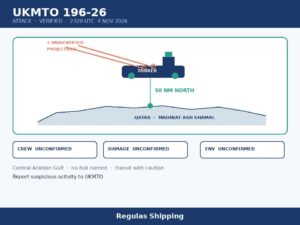
This is not UKMTO 196-26, not this morning’s dedicated 797/26 Mentor, and not IMO’s 128-count. Thursday morning’s dedicated 196-26 remains a Verified Attack on an unnamed tanker 50 nautical miles north of Madinat ash Shamal. This morning’s dedicated 797/26 remains unmanned tanker Mentor, IMO 9340374, 43-25.1N 028-37.0E, east of Cape Kaliakra; official English on hs-navy.mod.bg has now taken that number — wrap on the Black Sea file. IMO remains 128 confirmed / 24 dead as at 3 November. NAVAREA IX still ends at 428/26. A South Aegean survey line does not belong on that tape.
Operational implications
For a master already shaping a Piraeus–Syros, Piraeus–Naxos, Lavrion–Paros, Hydra / Spetses coastal, Kythnos–Serifos, or Ikaria west-approach passage from 5 November, Thursday morning is a CPA and lookout problem before it is a security rewrite. The Hydrographic Service named the hull and printed a 21-point line, not a circle. The western end sits in the southern Saronic, on the doorstep of the Poros / Methana face and the Hydra approaches. The eastern end sits west of Ikaria, south of the Mykonos–Ikaria lane. A passage plan that only budgeted 0169/26’s Central Mediterranean dotted line, or that treated the South Aegean as clean because 1322/26’s submarine box kills itself at 1500 UTC, has not budgeted a named survey ship that is on the water today. Survey gear in the water, even when a NAVWARN is silent on RAM status, is a close-quarters and fishing-gear problem. Give the hull a wide practical berth. Do not pass between the ship and unmarked gear. Do not assume AIS will show streamers, buoys or a towed array. Do not assume night work is off because hours were not printed.
The same-day exercise split is the operational content a DPA has to get right. 1322/26 still tells the bridge to avoid a Myrtoo submarine box through 1500 UTC today. 1326/26 still tells the bridge to avoid Diaporia underwater firing from 1500 UTC to 2000 UTC today. 1325/26’s Ydra live-firing window has already closed. 1336/26 is none of those boxes. It is a moving hull on a long line with a wide-berth request and no printed end. A passage plan that only plotted the four-corner submarine box, or that treated 1500 UTC as an all-clear for the South Aegean, has not budgeted NG SURVEYOR. Charterers asking whether “the Aegean is closed for a submarine exercise until 1500 UTC” will not be answered by this file. What arrived is a survey line that outlives this afternoon’s boxes, not a firing-box all-clear.
1320/26, used only as wrap, is the local reminder that this hull was already working a short Saronic calibration on 3 and 4 November. That colour does not amend 1336/26. It does tell a master inbound to Piraeus, Lavrion, Poros or Hydra not to treat the 21-point line as a paper exercise. If the hull is encountered, COLREGS Rule 18 and a practical wide berth apply whether or not the NAVWARN printed RAM. Report actual close-quarters, gear in the water, or an unlit hull to JRCC Piraeus and to the company security officer. Logging 1336/26 is not a substitute for a sighting report. 1324/26’s canal closure remains a separate routing fact for hulls that would otherwise have used Corinth; it is not a 1336/26 diversion order.
Keep the dedicated files on their own lines. 0169/26 remains Monday afternoon’s dedicated Britoil Centurion Central Mediterranean track through 15 February 2027. 0168/26 remains Monday afternoon’s dedicated weekly group 44 through 092359 UTC 9 November. 1322/26, 1325/26, 1326/26 and 1324/26 remain wrap. 1320/26 remains wrap on this hull’s 3–4 November calibration. 1314/26 remains wrap on RN GAIA BLU. This morning’s dedicated 797/26 remains Mentor east of Cape Kaliakra; official English has now taken it. This morning’s dedicated 790/26 remains two drifting containers east of Maslen Nos. Thursday morning’s dedicated 196-26 remains the Qatar tanker Attack. IMO remains 128 / 24 as at 3 November. UKMTO now ends at 196-26. NAVAREA IX still ends at 428/26. Do not recast 5 November morning as a South Aegean exclusion zone, as a 0169 rewrite, as a 1320 extension, as a canal-closure diversion, or as a completed 1322 all-clear.
What Operators Should Note
- Log 1336/26 as a named-hull South Aegean survey line, not as a 0169/26 rewrite and not as a 1320/26 extension. Official Hellenic NAVWARN 1336/2026, English board 5 November 2026. South Aigaio Sea. Geophysical survey by NG SURVEYOR from 5 November 2026 in the line between 21 points from 37-45.30N 023-07.20E to 37-14.63N 025-40.78E. Wide berth requested. The warning names neither IMO, flag, VHF, keep-clear radius, RAM status, fishing ban, daily hours nor a cancel DTG. SeaLagom first carried the text at 00:00 UTC on 5 November, updated 09:22 UTC. Replace nothing in the 0169/26 folder; add this number on the Aegean sheet.
- Plot the 21-point line, not a single circle. Western end: southern Saronic, south of Aegina, west of the Poros / Methana face, 37-45.30N 023-07.20E. Then east-southeast through 023-18E / 023-35E, south of Kea, Kythnos, Serifos and Sifnos, south of Paros / Naxos, ending west of Ikaria at 37-14.63N 025-40.78E. Piraeus outbound, Lavrion, Hydra / Spetses, Kythnos–Serifos, Paros–Naxos south and the Ikaria west approach all see a point. Do not brief a corridor closure. Do not drop the eastern end because the next port is Piraeus.
- Hold the 5 November start and the missing end date. Work is in force today, 5 November, with no printed kill time and no daily hours. Do not apply 1322/26’s 1500 UTC submarine-box window to this number. Do not apply 0169/26’s 15 February end to this number. Do not treat 5 November as a one-day survey. Watch a later Hellenic NAVWARN that moves a point, adds a radius, prints RAM language, names an IMO, or cancels 1336.
- Do not promote 1320/26, 1322/26, 1324/26 or 1314/26 onto this survey. 1320/26 remains wrap: NG SURVEYOR calibration of subsea equipment in the Saronic on 3 and 4 November, two points, wide berth requested. 1322/26 remains wrap: Myrtoo submarine box, 0500–1500 UTC 5 November, avoid crossing. 1325/26 remains wrap: Ydra live firing, 0600–1000 UTC 5 November, already past. 1326/26 remains wrap: Diaporia underwater firing, 1500–2000 UTC 5 November. 1324/26 remains wrap: Corinth Canal closed from 03 November 04:00Z until further notice. 1314/26 remains wrap: RN GAIA BLU, different hull, different South Aegean box. Use those files to keep the day’s Aegean tape in order, not to amend 1336/26.
- Keep 0169/26 as the Central Mediterranean track, not as a veto on 1336. Dedicated 0169/26 remains Britoil Centurion, IMO 9619177, MMSI 566921000, days 5 November 2026 to 15 February 2027, two dotted-line groups in the Tyrrhenian and Sardinia Channel. Dedicated 0168/26 remains weekly group 44 through 092359 UTC 9 November. A Greek coastal NAVWARN does not belong on that Spanish weekly list. Do not wait for weekly group 45 before the bridge plots 37-45.30N 023-07.20E.
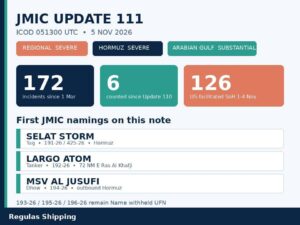
- Keep the security tape on its own sheet. Thursday morning’s dedicated 196-26 remains the Qatar tanker Attack, 2320 UTC 4 November, 50 nautical miles north of Madinat ash Shamal. This morning’s dedicated 797/26 remains Mentor east of Cape Kaliakra; official English has now taken it. This morning’s dedicated 790/26 remains two drifting containers east of Maslen Nos. IMO remains 128 / 24 as at 3 November. UKMTO now ends at 196-26. NAVAREA IX still ends at 428/26. No 197-26, no 429/26, no Update 111, no IMO 129 this run. Sightings of the hull, gear in the water, or a close-quarters situation go to JRCC Piraeus and to the CSO.
Regulas Shipping will keep lining NAVWARN 1336/26 against Monday afternoon’s dedicated 0169/26 and against today’s wrap 1322/26 so operators can treat Thursday’s Aegean tape as a named NG SURVEYOR geophysical line from 5 November, not as a Mediterranean exclusion zone, a Saronic calibration extension, or a completed rewrite of this afternoon’s submarine box.