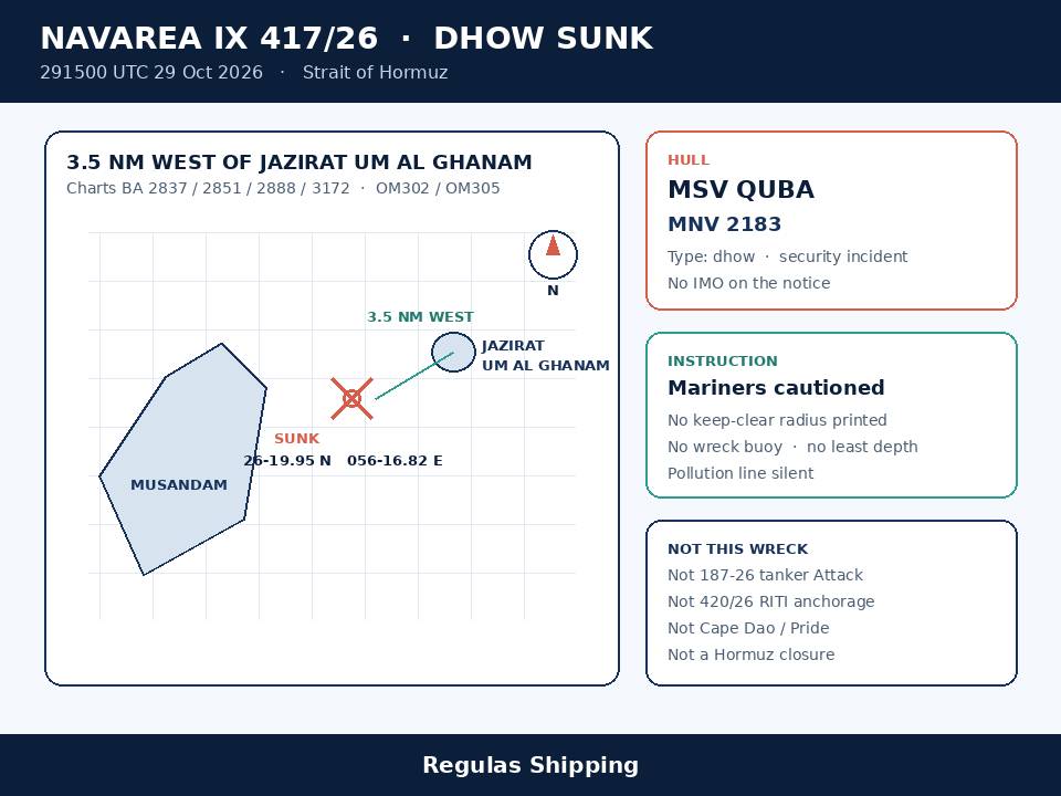
The Hydrographer of Pakistan issued NAVAREA IX 417/26 at 291500 UTC on 29 October for the Strait of Hormuz, charts BA 2837, 2851, 2888 and 3172 and Oman charts OM302 and OM305. The official text states that dhow MSV Quba, MNV 2183, is reported involved in a security incident and sunk in 26-19.95N 056-16.82E, approximately 3.5 nautical miles west of Jazirat Um Al Ghanam, and cautions mariners. That is the working primary. It is a wreck product. It is not a new 29 October tanker Attack PDF, not a rewrite of Thursday late-morning’s dedicated Warning 185-26 fire sighting, and not an International Maritime Organization board increment past 121.
Pakistan’s Friday in-force table still carries 417/26 as STRAIT OF HORMUZ / DHOW SUNK. It does not print a wreck buoy, a light, a keep-clear radius, a least depth, a cargo, a bunker figure, a pollution line, a crew count or an attacker. Thursday late-morning’s dedicated 185-26 piece on this desk, published about 11:35 UTC, still told operators that Pakistan’s table ended at 416/26 and that there was no 417/26 wrap on the 9-nautical-mile north-of-Khasab fire. 417/26 was not on that board when that note was written. Masters who brief Friday as a second Cape Dao, as a named tanker wreck, or as Update 109 will have merged three other series into a new dhow plot.
What the warning actually printed
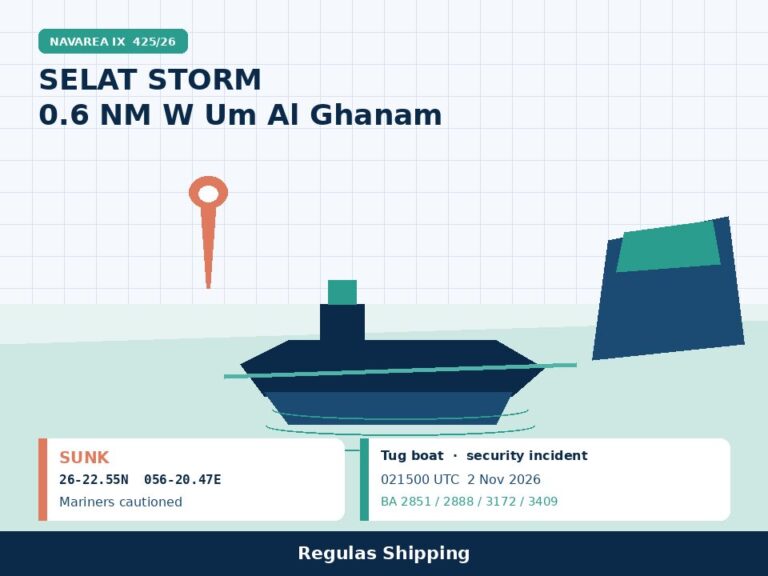
The hydrographic text is short. DTG 291500 UTC OCT 2026. NAVAREA IX 417/26. STRAIT OF HORMUZ. Charts BA 2837, 2851, 2888, 3172 and Oman OM302, OM305. DHOW (MSV QUBA MNV 2183) REPORTED INVOLVED IN A SECURITY INCIDENT AND SUNK IN 26-19.95N 056-16.82E APPROXIMATELY 3.5NM WEST JAZIRAT UM AL GHANAM. MARINERS CAUTIONED. That is the product. Stay with that wording. The coordinator printed neither a wreck buoy, a light, a sinking clock inside 29 October, a cargo, a bunker figure, a pollution line, a crew revision, a keep-clear radius, nor an attacker. Do not invent a five-cable or one-nautical-mile circle around 26-19.95N 056-16.82E. 417/26 does not print one. Do not invent an IMO number. The notice prints MSV Quba and MNV 2183. It does not print an IMO.
The type line on the NAVAREA is dhow. That is the first briefing fact. Thursday’s dedicated 185-26 PDF printed “vessel,” not tanker and not dhow. Industry colour on that clock, already held separately on the 185-26 piece, had added tanker, projectile and mostly-submerged lines that the UKMTO PDF did not print. 417/26 is the first official hydrographic instrument that types the casualty as a dhow and names it. Do not convert Friday’s wreck notice into a crude or products finding. Do not invent a cargo from a dhow type field. Do not put Louise 1, RITI, Ghana Prosperity or Cape Dao onto this plot because those names are easier to brief than MSV Quba.
The geometry is the second briefing fact. 26-19.95N 056-16.82E sits about 3.5 nautical miles west of Jazirat Um Al Ghanam and on the order of 8 to 9 nautical miles north-northeast of Khasab, which is the same water as Thursday’s 185-26 offset of 9 nautical miles north of Khasab. Hold both descriptions. 185-26 printed a Khasab offset and no lat/long. 417/26 prints a lat/long and a Jazirat Um Al Ghanam offset and no Khasab line. One wreck. Two official descriptions. Not two incidents, and not a proof that 185-26 was a tanker. Do not move Cape Dao’s 15-nautical-mile northeast-of-Khasab IMO row onto this Friday plot because both files sit off Musandam. Cape Dao remains IMO 9219020, 23 September, 15 nautical miles northeast of Khasab, sunk on the IMO board, wreck later plotted 35 nautical miles east of Sohar on dedicated 403/26 and later cancelled by 410/26. Quba is a different name, a different type and a different date.
UKMTO wrap of the same clock, held as wrap not as the primary: Thursday’s dedicated Warning 185-26 remains the fire-sighting file, Suspicious Activity, 29 October 2026, 0300 UTC, Third Party, 9 nautical miles north of Khasab, master of a third-party vessel sighted another vessel on fire, crew then unknown, no damage or environmental-impact report. Industry reprints of Warning 185-26 Update 001 quote UKMTO as saying regional authorities identified the vessel as a dhow involved in a maritime security incident, igniting a large fire onboard causing the dhow to list and sink, with local authorities confirming the crew were safely evacuated. This desk did not retrieve that Update 001 PDF on this run. Treat that quoted language as UKMTO wrap on the 185-26 number. Do not substitute it for 417/26. The NAVAREA is the first instrument that names MSV Quba, prints MNV 2183, and plots 26-19.95N 056-16.82E. 417/26 does not reprint a crew-evacuated line. Do not close a SAR file from a mariners-cautioned wreck notice, and do not reopen one from a quote that 417/26 does not carry.
What this is not
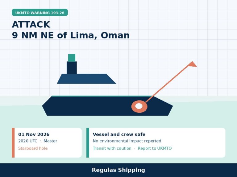
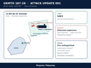
This is not a rewrite of 187-26, and it is not a tanker Attack. Friday’s dedicated Warning 187-26 Update 001 remains an unnamed outbound tanker Attack, 2212 UTC 29 October, 25 nautical miles northeast of Khasab, port-side small boat, two explosive devices attached above the waterline, engine-room fire, temporarily disabled, fire extinguished, crew safe, no environmental impact, continuing to next port of call. Twenty-five nautical miles northeast of Khasab is not 3.5 nautical miles west of Jazirat Um Al Ghanam. A continuing tanker is not a sunk dhow. Do not merge Thursday night’s Attack onto Friday’s wreck because both sit in the Strait of Hormuz on a 29 October clock.
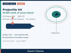
This is not a rewrite of 186-26, and it is not NAVAREA IX 420/26. Thursday afternoon’s unused Warning 186-26 remains a CSO Attack: tanker struck by an unknown projectile at 1600 UTC whilst completing an outbound Hormuz transit, no reported injuries, no environmental impact report. 420/26, issued 300300 UTC 30 October, names oil tanker RITI, security incident causing fire onboard, anchored in 26-24.07N 056-24.72E, approximately 1 nautical mile northwest of Ra’s Tahir, mariners cautioned. RITI is a tanker. Quba is a dhow. 26-24.07N 056-24.72E is not 26-19.95N 056-16.82E. Hold 420/26 as a separate Friday NAVAREA naming, unused as a dedicated rewrite of this wreck. Do not put RITI on the Quba plot. Do not put Quba on the RITI plot.
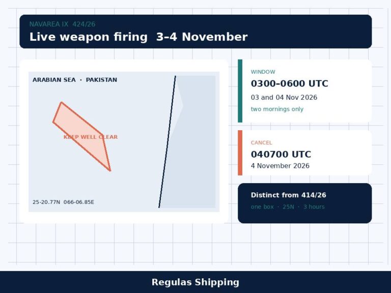
This is not GFS Pride, Ghana Prosperity or Cape Dao. Pride remains the dedicated 13 October container-ship wreck, later cancelled as a live NAVAREA by 410/26. Ghana Prosperity remains the dedicated 404/26 4.5-nautical-mile south-of-Musandam caution, later cancelled by 410/26, and is now the Update 109 naming against Warning 182-26 as wrap, not as this dhow. Cape Dao remains the 23 September casualty and the later Sohar-offset wreck file. Quba is not on those rows. 418/26 and 419/26 on Friday’s Pakistan table are self-cancelling housekeeping. They are not this wreck. 416/26 remains wrap on Wednesday night’s dedicated 184-26 Gulf of Aden PAG keep-clear through 032359 UTC 3 November. 414/26 remains the dedicated November Pakistan live-firing boxes. None of those numbers is a Musandam dhow.
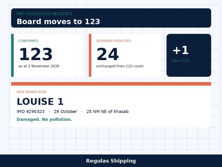
This is not Update 109, and it is not an International Maritime Organization 122-count. JMIC Update 109, JMIC# 001 26, ICOD 291300 UTC 29 October, remains the last numbered public periodic note, with Hormuz SEVERE, the Arabian Gulf SUBSTANTIAL, the Gulf of Oman MODERATE and 160 incidents since 1 March. Update 109 still lists 185-26 as Unknown / Suspicious activity / vessel on fire 9 nautical miles north of Khasab, crew status unknown. 417/26 at 291500 UTC sits two hours after that cut-off. It is not on that note. The IMO highlighted-incidents board is still 121 confirmed / 24 seafarer fatalities as at 27 October, with Leonora Kosan still the newest named row. 417/26 does not fill those slots and does not print an IMO number. Wednesday afternoon’s dedicated JMIC Advisory Note 016-26 remains the blockade visit-and-search document pack. This is not Thursday’s dedicated Contship Jet or Khoryv Black Sea files. NAVWARN 768/26 and 766/26 are Kaliakra and Shabla products. They do not belong on a Musandam wreck.
Operational implications
For a master already in the Strait of Hormuz, shaping an outbound or inbound transit past Musandam, or working Khasab, Bukha, Limah, Fujairah or Khor Fakkan this morning, Friday is a named, positioned dhow wreck 3.5 nautical miles west of Jazirat Um Al Ghanam before it is a war-risk rewrite. Update 109 remains the last numbered JMIC note and still prints Hormuz SEVERE. 016-26 remains the working blockade document pack: continuous VHF 16, follow US forces, be prepared to alter, stop or come dead in the water, and have the six signed-or-stamped PDFs ready. 417/26 adds a plotted obstruction on BA 2837 / 2851 / 2888 / 3172 and OM302 / OM305 where Thursday’s 185-26 file still had an unnamed fire sighting and no lat/long. A passage plan that only carried the 9-nautical-mile north-of-Khasab offset, or that treated Musandam as clear because 410/26 cancelled the Pride / Cape Dao / Ghana Prosperity cautions, has not budgeted 26-19.95N 056-16.82E.
Mariners cautioned is the printed instruction, not a harbour closure and not a buoyed wreck. 417/26 does not close Khasab, Bukha, Limah, Fujairah, Khor Fakkan or the Strait of Hormuz. It does not mark the wreck. It does not say the hull is on the bottom in a surveyed attitude. It does not give a least depth. Night transits, restricted-visibility transits and any traffic that has been hugging the Omani coast to stay off the Iranian-controlled northern Hormuz route now carry a named dhow wreck on the Um Al Ghanam offset. Plot the position, add sea-room beyond a default CPA, and keep a lookout for wreckage. Do not invent a five-cable circle because Khoryv’s dedicated 766/26 prints one in the Black Sea. That radius is not this notice.
A pollution watch remains open because the instrument is silent. 417/26 prints sunk and mariners cautioned. It does not print a hydrocarbon line, a boom, a cargo or a bunker figure. Thursday’s 185-26 PDF printed no environmental-impact report. Industry reprints of 185-26 Update 001 quote a crew evacuation and a sinking and still do not print a spill. That is not a clean bill. A dhow that burned, listed and sank can leave fuel. Charterers and P&I will ask for 26-19.95N 056-16.82E, the 3.5-nautical-mile west-of-Um-Al-Ghanam offset, the MSV Quba / MNV 2183 naming, and the still-open IMO board that has not taken this hull. They will not be answered by Thursday’s unnamed 185-26 fire sighting alone. Flag, class and wreck-removal work remain with whoever holds the dhow. None of those names is on 417/26.
For a DPA and an operator with any merchant hull still using the southern Hormuz corridor, the reporting split is the operational content. Sightings of the wreck, wreckage, persons in the water or pollution go to the NAVAREA / coastal-warning system, to UKMTO on the 185-26 action line if the sighting is still being treated as that fire, and to the company security officer. NAVCENT NCAGS remains the 016-26 blockade mailbox. MSCIO remains the EU ATALANTA registration and alert desk. Registering with one mailbox is not a substitute for the others. 417/26 does not order an armed team, a daylight-only transit, or a halt to visit-and-search compliance. It also does not authorise a master to treat a dhow wreck as a confirmed tanker Attack, a RITI conversion, or a Cape Dao rewrite. Log the NAVAREA number, the 291500 UTC clock, the name MSV Quba, MNV 2183, the plot 26-19.95N 056-16.82E, the 3.5-nautical-mile west-of-Jazirat-Um-Al-Ghanam offset, the dhow type, and the mariners-cautioned line. Do not log an IMO number, a keep-clear radius, a tanker cargo, or an attacker that the notice does not print.
Keep the dedicated files on their own lines. 185-26 remains Thursday’s 9-nautical-mile north-of-Khasab fire sighting. 187-26 remains Friday’s dedicated unnamed tanker Attack 25 nautical miles northeast of Khasab. 186-26 remains the unused 1600 UTC unknown-projectile Attack. 420/26 remains the unused RITI fire-and-anchor NAVAREA. 184-26 / 416/26 remains the Gulf of Aden PAG keep-clear through 3 November. 182-26 remains the 23 October outbound disablement, Ghana Prosperity on Update 109 as wrap only. 181-26 / Leonora Kosan remains Limah. 179-26 / Al Dasma remains Bukha. Cape Dao remains 403/26 / the 23 September IMO row. Pride remains the 13 October container wreck. Update 109 remains the last periodic threat note, Hormuz still SEVERE, 185-26 still Unknown on that note. 016-26 remains Wednesday afternoon’s blockade document pack. Thursday’s 768/26 and 766/26 remain the Kaliakra and Shabla Black Sea files. Do not recast 30 October as a tanker wreck, as Update 110, as an IMO 122-count, or as a Hormuz closure.
What Operators Should Note
- Log 417/26 as a named dhow wreck, not as a tanker Attack and not as a second Cape Dao. NAVAREA IX 417/26, 291500 UTC 29 October. STRAIT OF HORMUZ. Charts BA 2837, 2851, 2888, 3172 and Oman OM302, OM305. Dhow MSV Quba, MNV 2183, reported involved in a security incident and sunk in 26-19.95N 056-16.82E, approximately 3.5 nautical miles west of Jazirat Um Al Ghanam. Mariners cautioned. The coordinator printed neither wreck buoy, keep-clear radius, least depth, pollution, crew count, IMO number nor attacker. This is not 187-26, not 186-26, not 420/26, not Cape Dao, and not Update 109.
- Hold 185-26 as the fire-sighting file, not as the wreck instrument. Dedicated Warning 185-26 remains Suspicious Activity, 0300 UTC 29 October, 9 nautical miles north of Khasab, unnamed vessel on fire, crew then unknown. Industry reprints of 185-26 Update 001 quote UKMTO as identifying a dhow that listed and sank with crew evacuated; this desk did not retrieve that PDF on this run. 417/26 is the first NAVAREA that names MSV Quba and plots the wreck. One water. Two instruments. Do not brief Friday as if Thursday’s PDF already named the hull.
- Plot 26-19.95N 056-16.82E, then add sea-room. About 3.5 nautical miles west of Jazirat Um Al Ghanam; on the order of 8 to 9 nautical miles north-northeast of Khasab. 417/26 is mariners cautioned, not a five-cable circle and not a buoyed wreck. Night and restricted-visibility transits on BA 2837 / 2851 / 2888 / 3172 and OM302 / OM305 now carry a named obstruction where 185-26 still had an offset and no lat/long. Khasab, Fujairah, Khor Fakkan and the Strait are not closed by this notice.
- Do not collapse RITI, Louise 1, Ghana Prosperity or Cape Dao onto this plot. 420/26 names oil tanker RITI at 26-24.07N 056-24.72E, 1 nautical mile northwest of Ra’s Tahir, fire, anchored. 187-26 remains an unnamed continuing tanker 25 nautical miles northeast of Khasab. Vanguard’s Louise 1 colour sits on 187-26, not on 417/26. Ghana Prosperity is Update 109 wrap on 182-26. Cape Dao remains the 23 September 15-nautical-mile northeast-of-Khasab IMO wreck, later the Sohar-offset 403/26 file. Quba is a dhow. Those tankers are not this wreck.
- Leave crew, pollution and attacker off this notice. 417/26 does not reprint a crew-evacuated line, a fatality line, a spill, a cargo or a weapon. Thursday’s 185-26 PDF left crew, damage and pollution unknown. Do not close a SAR file, a bunker survey or an attribution from a mariners-cautioned wreck. Watch a later NAVAREA that marks a buoy, prints a least depth or prints pollution; a retrieved 185-26 Update 001 PDF; a flag note; a JMIC Update 110; or an IMO-board row.
- Do not move the official boards from this notice. IMO remains 121 confirmed / 24 dead as at 27 October, Leonora Kosan still the newest named row. Update 109 ICOD remains 291300 UTC 29 October, Hormuz SEVERE, 185-26 still Unknown / Suspicious activity on that list, 160 incidents since 1 March. 016-26 remains the blockade document pack. 418/26 and 419/26 are self-cancelling housekeeping. 416/26 remains the Aden PAG wrap through 3 November. Watch the in-force list, not a headline that Friday morning closed Musandam.
Regulas Shipping will keep lining NAVAREA IX 417/26 against Thursday’s dedicated 185-26 fire sighting so operators can treat Friday’s tape as a named dhow wreck 3.5 nautical miles west of Jazirat Um Al Ghanam, not as a tanker Attack, a Cape Dao rewrite, or a closed survey.