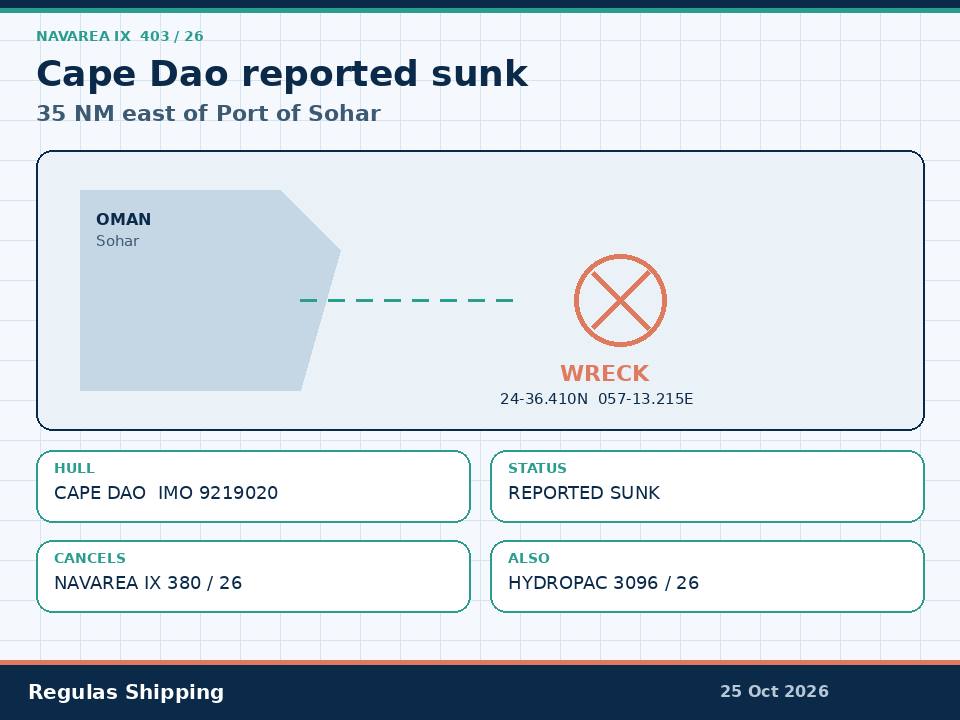
The Hydrographer of Pakistan issued NAVAREA IX 403/26 at 240300 UTC on 24 October for the Strait of Hormuz charts BA 2837, 2851 and 3171 and Oman chart OM1216. The official text states that oil tanker MV Cape Dao, earlier involved in a security incident on 23 September 2026, is reported sunk in 24-36.410N 057-13.215E, approximately 35 nautical miles east of Port of Suhar, and cautions mariners. Paragraph 2 cancels NAVAREA IX 380/26. That is the working primary. It is a wreck product. It is not a new 24 October Attack PDF, not a rewrite of the dedicated 24 September Cape Dao casualty file, and not an International Maritime Organization board increment past 120.
NGA HYDROPAC 3096/26 reprints the same wreck as a Gulf of Oman notice: M/V Cape Dao sank in 24-36.41N 057-13.22E, cancels HYDROPAC 3013/26 and 3095/26, and self-cancels at 011736Z November 2026. Hold both instruments against one hull and one position. The NAVAREA coordinator printed Strait of Hormuz on the header and Port of Suhar in the body. HYDROPAC printed Gulf of Oman. The lat-long is the same. Do not invent a second sinking. Do not invent a pollution volume. Do not invent a wreck buoy.
This is the hydrographic finding that Update 106, ICOD 181300 UTC 18 October, still refused. That note treated NAVAREA IX 380/26 as a sinking-and-drifting caution about 33 nautical miles northeast of Port Al Suwaiq and said the ship had not sunk. The IMO highlighted-incidents board, as at 22 October, still prints CAPE DAO, IMO 9219020, 23 September, 15 nautical miles northeast of Khasab, Oman, damaged, no pollution, one seafarer fatality, partially sunk. JMIC Update 107, ICOD 221300 UTC 22 October, named Chloe, Al Dasma and Soyia and did not convert this hull into a completed wreck. Saturday’s 403/26 is the first NAVAREA that prints REPORTED SUNK against a plotted Sohar offset. Masters who brief Sunday as a second Cape Dao attack, as an IMO 121-count, or as a closed pollution survey will have merged four products.
What the warning actually printed
The hydrographic text is short. DTG 240300 UTC OCT 2026. NAVAREA IX 403/26. STRAIT OF HORMUZ. Charts BA 2837, 2851, 3171 and Oman OM1216. OIL TANKER (MV CAPE DAO) EARLIER INVOLVED IN A SECURITY INCIDENT ON 23 SEP 26 REPORTED SUNK IN 24-36.410N 057-13.215E APPROXIMATELY 35NM EAST PORT OF SUHAR. MARINERS CAUTIONED. CANCEL NAVAREA IX 380/26. That is the product. The coordinator printed neither a wreck buoy, a light, a sinking clock inside 24 October, a cargo, a bunker figure, a pollution line, a crew revision, nor an attacker. HYDROPAC 3096/26 adds the 1 November 1736Z cancel and does not add a survey.
The type line on the NAVAREA is oil tanker. The dedicated 24 September file on this desk, the IMO board and the open registers print a Capesize bulk carrier. Hold both. Do not convert Saturday’s wreck notice into a crude or products finding. Do not invent a cargo from the coordinator’s type field. Open-register colour, already used on the dedicated casualty piece and still not a NAVAREA finding: IMO 9219020, Antigua and Barbuda, about 289 metres, about 84,448 gt / 170,089 dwt, built 2002, MMSI 305017400, registered owner ForthMarin Corp Ltd, ISM and commercial management Peonies Shipmanagement FZE. Former names Cape Qingdao, Bluemoon and Formosabulk Energy stay on that sheet. They are not a 24 October naming.
The geometry moved. NAVAREA IX 370/26, 131520 UTC 13 October, put Cape Dao sinking at 24-44.2N 056-47.7E. NAVAREA IX 380/26, 161550 UTC 16 October, put her sinking and drifting eastward at 0.5 knot in 24-21.48N 057-40.65E, about 33 nautical miles northeast of Port Al Suwaiq, and cancelled 370/26. Saturday’s 403/26 cancels 380/26 and fixes the wreck at 24-36.410N 057-13.215E, about 35 nautical miles east of Sohar. That is a Gulf of Oman coastal-track problem, not the original 23 September Musandam hit. Oman’s Maritime Security Centre placed that strike about 2.5 nautical miles off Musandam; an earlier NAVAREA used 26-24.60N 056-25.10E, about 2.5 nautical miles northeast of Ras Makhbuq. IMO still prints 15 nautical miles northeast of Khasab and “partially sunk.” Hold the 23 September Musandam / Khasab casualty geometry beside the 24 October Sohar wreck. One hull. Two official positions. Not two incidents.
What this is not
The dedicated 24 September piece remains the named-hull, crew and weapon file. UKMTO recorded an unknown-projectile hit on a cargo vessel at about 0630 UTC on 23 September, fire, adrift, crew evacuated, initially two casualties, no reported environmental impact. Oman evacuated 27 surviving crew. One seafarer was killed. India’s embassy and the Forward Seamen’s Union of India named him as Suraj Yadav, a wiper from Deoria. UKMTO stayed with unknown projectile. Do not reopen that casualty table from a wreck notice. Do not adopt a torpedo finding the dedicated file already refused. Do not reprint the 27-ashore count as a 24 October rescue.
This is not GFS Pride. NAVAREA IX 373/26 remains the 14 October Pride wreck at 26-16.8N 056-08.6E, about 4 nautical miles northwest of Ras Shaykh Masud, with floating containers. Pride is a container ship on the IMO board, dated 13 October, sunk, no pollution. Cape Dao is a different hull, a different date and a different chart. Do not merge the two Sunday wrecks onto one Musandam corridor briefing.
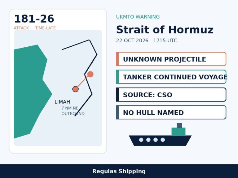
This is not Warning 181-26. Friday’s dedicated Limah file remains an unnamed outbound tanker hit at 1715 UTC on 22 October, 7 nautical miles northeast of Limah, continued voyage, no hull on the PDF. This is not 179-26 / Al Dasma, not 180-26 / Soyia, not 178-26 / Chloe, and not Thursday’s IRGC 4+3 claim. Update 107 still does not list 181-26 and still does not print Cape Dao as sunk. The IMO board is still 120 confirmed / 24 seafarer fatalities as at 22 October. Saturday’s wreck notice does not move that count. It does not close the fatality line. It does not name 176-26.
Operational implications
A named, positioned wreck 35 nautical miles east of Sohar is a collision and traffic-separation problem on the Gulf of Oman coastal track before it is a war-risk rewrite. Masters inbound to Sohar, outbound from Fujairah toward the eastern Gulf of Oman, and any hull routing AIS-off along the Omani coast now have a plotted obstruction where Update 106 still had a drifting, not-sunk caution. 403/26 cancels the 0.5-knot eastward drift. It does not mark the wreck. It does not say the hull is on the bottom in a surveyed attitude. It does not give a least depth. Night transits, restricted-visibility transits and any traffic that has been hugging the Omani coast to stay off the Iranian-controlled northern Hormuz route now carry a named wreck on BA 2837 / 2851 / 3171 and OM1216.
Sohar, Fujairah and Khor Fakkan are not closed by this notice. The Strait of Hormuz is not closed by this notice. A wreck 35 miles east of Sohar is not a Musandam TSS blockage and not a Fujairah anchorage closure. Do not brief a port shutdown from a mariners-cautioned wreck. Do brief a waypoint, a lookout and a passage-plan amendment. HYDROPAC 3096/26 remains live until 1 November 1736Z unless cancelled earlier. After that clock, do not assume the wreck has been removed. Assume only that the HYDROPAC self-cancel has fired. The NAVAREA has no self-cancel in the text that reached this desk.
A pollution watch remains open because both instruments are silent. The IMO board still prints no pollution against the 23 September row. The dedicated casualty file printed no environmental impact at warning time. Saturday’s wreck notice still prints no hydrocarbon line, no boom and no closed beach. That is not a clean bill. A 289-metre Capesize that burned, drifted and then sank can leave bunkers. Charterers and P&I will ask for 24-36.410N 057-13.215E, the cancel of 380/26, the HYDROPAC 1 November clock, and the still-open IMO “partially sunk / no pollution” line. They will not be answered by the 24 September Attack file alone. Flag, class and wreck-removal work remain with Antigua and Barbuda, the DOC holder and whoever takes the wreck. None of those names is on 403/26.
JMIC Update 107 still holds Hormuz at SEVERE, the Arabian Gulf at SUBSTANTIAL and the Gulf of Oman at MODERATE. Replace 380/26 in the master’s pack with 403/26. Do not replace Update 107. Do not replace Friday’s 181-26 file. Do not treat a Sohar-offset wreck as evidence that independent Hormuz transits have resumed or that the Fujairah density printed on Update 107 has cleared.
What Operators Should Note
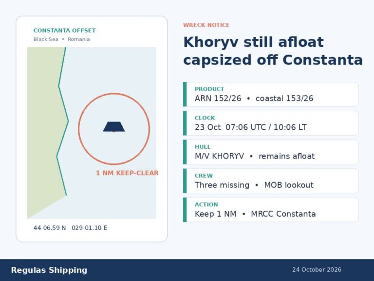
- Log a plotted wreck, not a second Cape Dao attack. NAVAREA IX 403/26, 240300 UTC 24 October. REPORTED SUNK, 24-36.410N 057-13.215E, about 35 nautical miles east of Port of Suhar. Cancels 380/26. HYDROPAC 3096/26 reprints the same position, cancels 3013/26 and 3095/26, self-cancels 011736Z November. This is the instrument Update 106 said had not yet been printed. It is not 181-26, not GFS Pride, not Khoryv, and not an IMO 121-count.
- Hold the type discrepancy and the two geometries. NAVAREA prints oil tanker. Dedicated 24 September file, IMO board and open registers print Capesize bulk carrier, IMO 9219020. Original hit remains 23 September off Musandam / 15 nautical miles northeast of Khasab on the IMO row. The wreck is now the Sohar offset. One hull. Do not invent a cargo. Do not invent a second incident.
- Plot the Sohar coastal track, not a harbour closure. Sohar, Fujairah, Khor Fakkan and the Strait are not closed. 403/26 is mariners cautioned, not a keep-clear radius and not a buoyed wreck. Night and restricted-visibility transits on BA 2837 / 2851 / 3171 and OM1216 now carry a named obstruction where 380/26 still had a 0.5-knot eastward drift.
- Leave the casualty table on the 24 September file. Unknown projectile, fire, adrift, 27 evacuated, one Indian seafarer killed. UKMTO stayed with unknown projectile. Saturday’s notice does not revise crew, weapon, pollution or attacker. Do not close a wreck-removal or a bunker survey from a mariners-cautioned line.
- Do not move the official boards from this notice. IMO remains 120 confirmed / 24 dead as at 22 October, Cape Dao still “partially sunk,” no pollution. Update 107 ICOD remains 221300 UTC 22 October. Hormuz SEVERE. Gulf of Oman MODERATE. There is no Update 108 and no Warning 182-26. Watch a later NAVAREA that marks a buoy, prints a least depth, or prints pollution — not a Hormuz closure.
- Keep HYDROPAC’s November cancel off the NAVAREA. 3096/26 dies at 011736Z November unless replaced. 403/26 has no self-cancel in the text used here. After 1 November, check the in-force list before dropping the wreck from the folder.
Regulas Shipping will keep lining Saturday’s NAVAREA IX 403/26 wreck position against the 23 September Cape Dao casualty file and the still-open IMO “partially sunk” row so operators can treat the Sohar offset as a plotted wreck, not as a second attack or a closed survey.